-
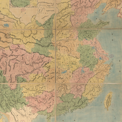
Notes on the map describe...
皇朝直省輿地全圖
Qing Guangxu period, 1887
-
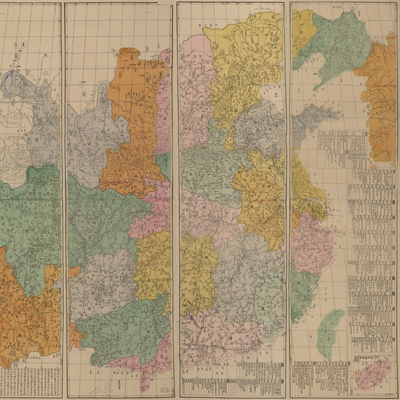
The legend along the left...
皇朝直省輿地全圖
Qing Guangxu period, 1896
-
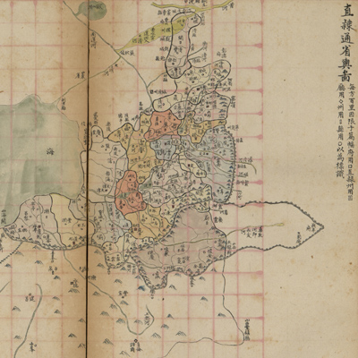
The maps are oriented wit...
直隸輿地圖冊
Qing Xianfeng period, 1859
-
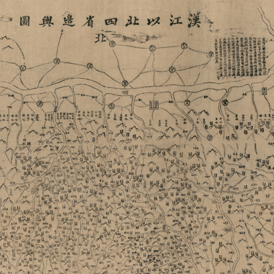
The title and north are a...
漢江以北四省邊輿圖
Qing Taokung period, 1821-1824
-
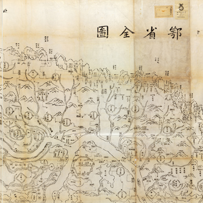
The map is oriented with ...
鄂省全圖
The 1st Year of Qing Tongzhi Reign, 1862
-
The title “Zhili Shangdon...
直隸山東兩省地輿全圖
Qing Xianfeng, Tongzhi period, 1855-1870
-
The orientation is marked...
浙江全圖
Mid-Qing period, 1773-1841
-
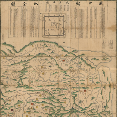
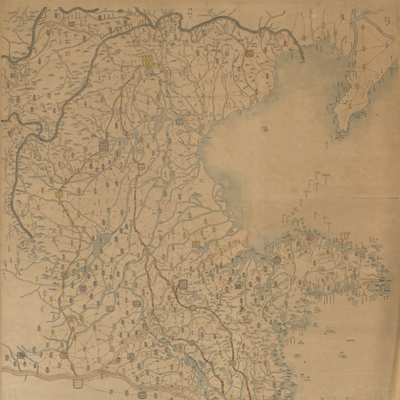
The map depicts the range...
盛京輿地全圖
Mid-18th century, 1734-1736
-
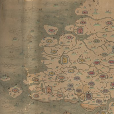
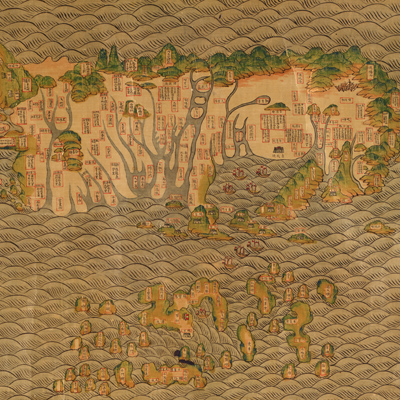
Qiongzhou's administrativ...
瓊郡輿地全圖
Mid-Qing period, -1836
-
The orientation is marked...
甘肅輿圖
Qing Xianfeng, Tongzhi period, 1855-1871
-
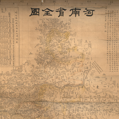
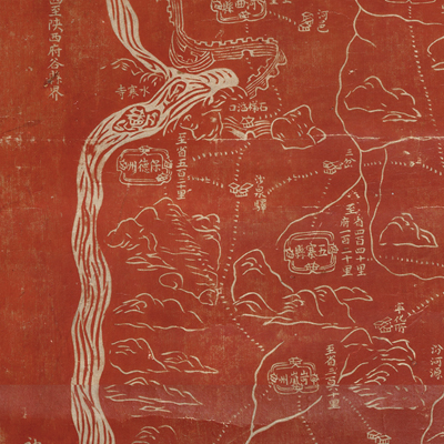
Prefatory notes state tha...
河南省全圖
Qing Guangxu Period, 1895
-
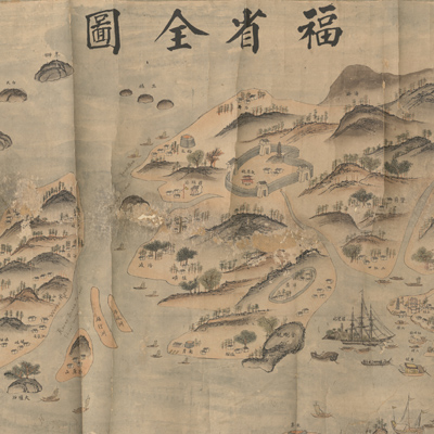
The map of Fujian doesn't...
福省全圖
late Qing period, 1842-1884
-
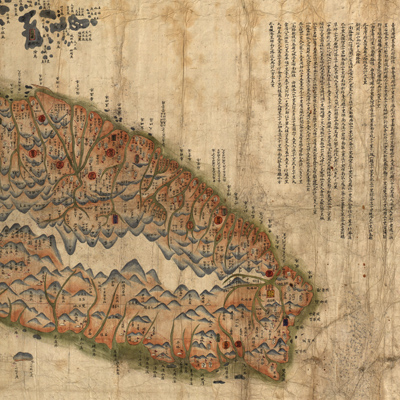
Taiwan Island faces Mainl...
臺灣前後山全圖
Qing Guangxu period, 1880
-
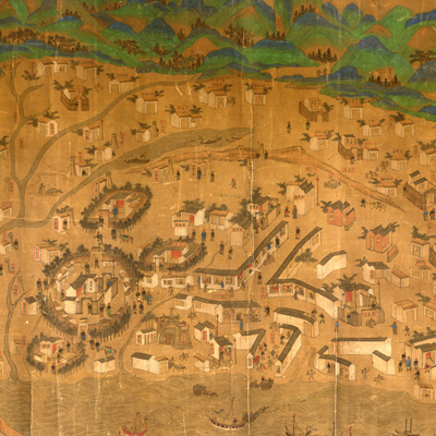
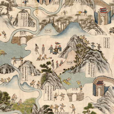
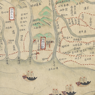
This is a pictorial view ...
臺灣地里圖
Qing Kangxi period, 1684-
-
Beijing serves as the pri...
全臺前後山輿圖
Qing Guangxu period, 1878
-
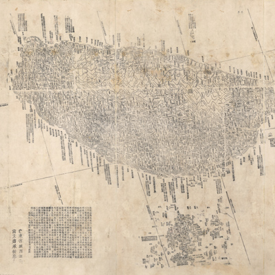
Part of the map is missin...
吉林輿圖
Qing Guangxu period 1882-1889
-
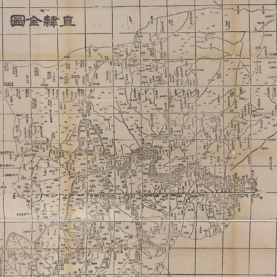
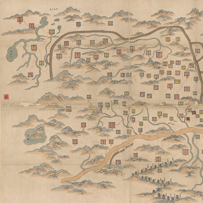
The map depicts Zhili Pro...
直隸全圖
Qing Tongzhi period, 1864
-
The title is pasted on th...
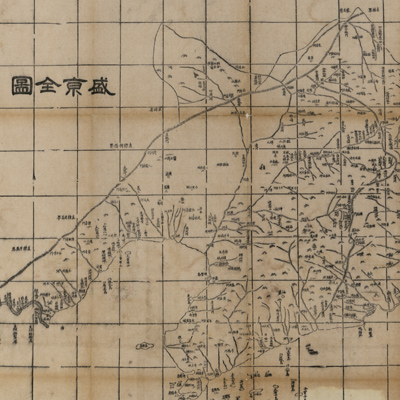
盛京全圖
Qing Tongzhi period, 1864
-
The map depicts mountains...
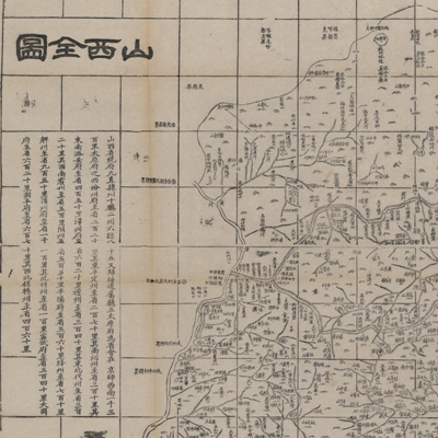
山西全圖
Qing Tongzhi period, 1864
-
The map depicts mountains...
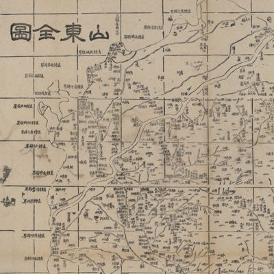
山東全圖
Qing Tongzhi period, 1864
-

The map depicts mountains...
河南全圖
Qing Tongzhi period, 1864
-
The map depicts mountains...
江蘇全圖
Qing Tongzhi period, 1864
-
The map depicts mountains...
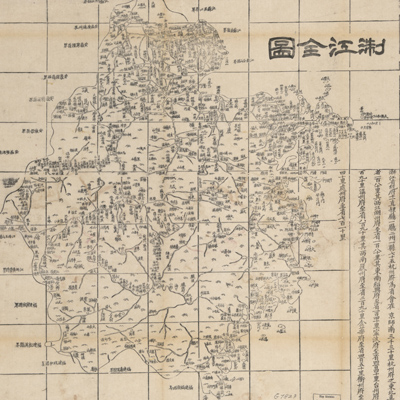
江西全圖
Qing Tongzhi period, 1864
-
The map depicts mountains...
湖南全圖
Qing Tongzhi period, 1864
-
The map depicts mountains...
陜西全圖
Qing Tongzhi period, 1864
-
The map depicts mountains...
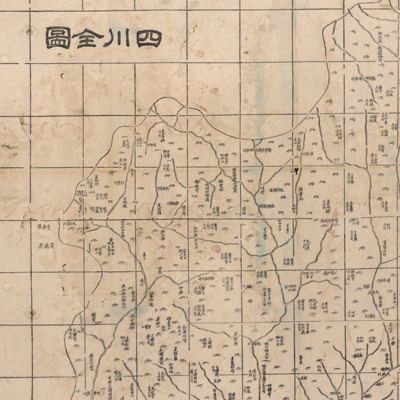
四川全圖
Qing Tongzhi period, 1864
-
The map depicts mountains...
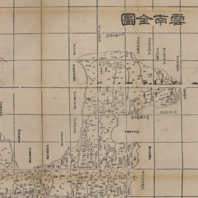
雲南全圖
Qing Tongzhi period, 1864
-

The map depicts mountains...
貴州全圖
Qing Tongzhi period, 1864
-
The map depicts mountains...
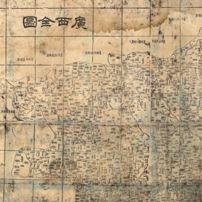
廣西全圖
Qing Tongzhi period, 1864
-
The map depicts mountains...
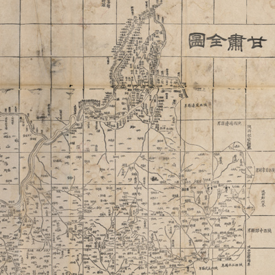
甘肅全圖
Qing Tongzhi period, 1864
-
The map depicts mountains...
浙江全圖
Qing Tongzhi period, 1864
-
The map depicts mountains...
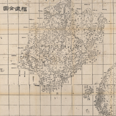
福建全圖
Qing Tongzhi period, 1864
-
The map depicts mountains...
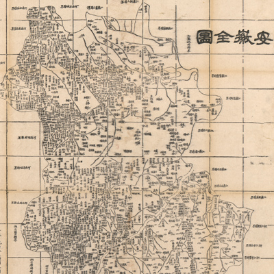
安徽全圖
Qing Tongzhi period, 1864
-
The map depicts mountains...
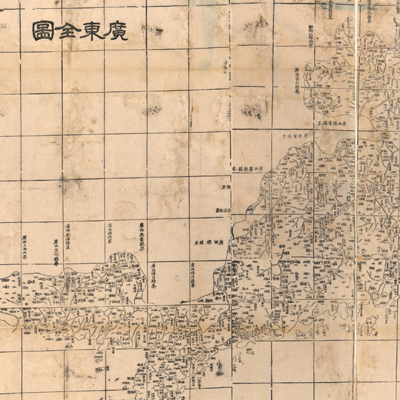
廣東全圖
Qing Tongzhi period, 1864
-
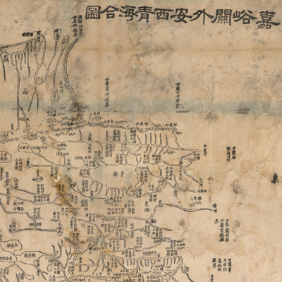
Orientation is clearly ma...
嘉峪關外安西青海合圖
Qing Tongzhi period, 1864
-
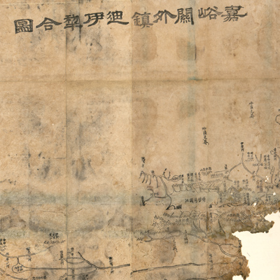
Torn at the bottom, a lar...
嘉峪關外鎮迪伊犁合圖
Qing Tongzhi period, 1864
-
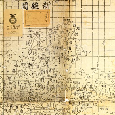
The Xinjiang area map is ...
新疆圖
Qing Tongzhi period, 1867-
-
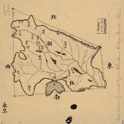
The sketched map only sup...
湖北省圖
Late Qing period, 1900
-
This set of four pictoria...
艾渾、羅剎、臺灣、艾渾、羅剎、臺灣、內蒙古之圖
Qing Kangxi period 1697-1722
-
Title is written on the u...
晉省地輿全圖
The 59th year of Qing Qianlong's reign, 1794.
-
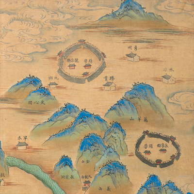
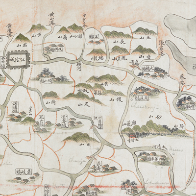
The atlas consists of 14 ...
江西十三府道里圖
Mid-Kangxi period, 1682-1691.
-
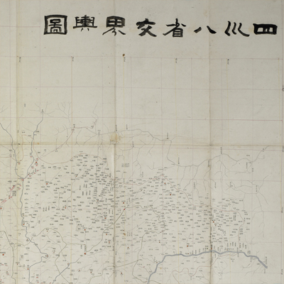
The title is written on t...
四川八省交界輿圖
Between Qing Tongzhi and Guangxu period, 1863-1899.
-
Title is written on the t...
廣東全省經緯地輿圖
Between Qing Jiaqing and Daoguang period, 1816-1832.
-

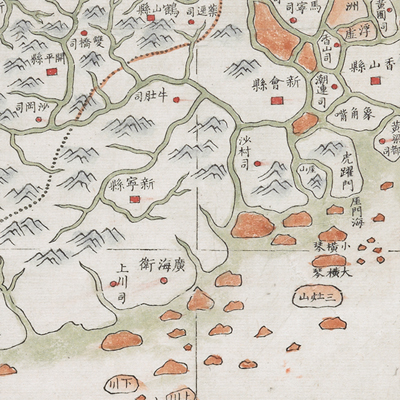
No orientation or legend ...
廣東全省輿圖
Around the 21st year of Jiaqing's reign, 1816.
-
The title is written on t...
江陰全圖
Early Tongzhi period, -1866.
-
No title appears on the m...
常州府武進陽湖兩縣鄉境與橋樑圖
Between Qing Daoguang and Xianfeng period, 1836-.
-
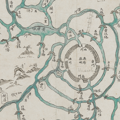
Original title was: “Wuxi...
無錫金匱輿地全圖
Between Qing Xianfeng and Tongzhi period, 1860-1866.
-
No title appears on this ...
臺灣里堡圖
Between late Qing Jiaqing and early Daoguang period, 1820-1829.