Military and Traffic Maps
海防圖未完稿
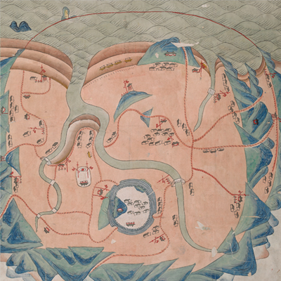
Unfinished Coastal Defense Map| Hanyu Pinyin | Hai fang tu wei wan gao |
|---|---|
| Date | Middle Qing period (?). |
| Measurement | |
| Techniques | Ink and color manuscript |
| Material | paper |
| Quantity | |
| Categories | |
| Country of Repository | |
| Identifier | British Library |
| Notes | Add. MS. 16358 (Q) |
| Share |
This, as the title suggests is an unfinished map. The map’s layout puts the sea at the top and mountain at the bottom. Towns, military posts, settlements are shown in the middle. The dotted black graphic lines on top of red lines may represent roads. The sea is represented by wave symbols, a typical style during Ming Dynasty and early Qing Dynasty. Mountains, military posts, and settlements are depicted in traditional pictorial symbols.
Since there is no text on the map, it is very hard to estimate when it was made. The map may have been drawn in the mid-Qing Dynasty or earlier judging from the mapping style and strokes.
Since there is no text on the map, it is very hard to estimate when it was made. The map may have been drawn in the mid-Qing Dynasty or earlier judging from the mapping style and strokes.