General Maps
遐覽指掌
Viewing distant places in the palm of your hand| Hanyu Pinyin | Xia lan zhi zhang |
|---|---|
| Creator | Anonymous |
| Date | Qing Shunzhi period, 1647 |
| Measurement | |
| Techniques | Pen-and-ink |
| Quantity | |
| Categories | |
| Country of Repository | |
| Identifier | Library of Congress |
| Link to Original Database | http://lccn.loc.gov/2002626721 |
| Acquisition Source | Arthur William Hummel |
| Acquisition Method | |
| Acquisition Date | 1930 |
| Share |
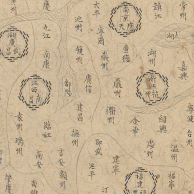
The atlas of the Ming Empire consists of 20 maps in thefollowing order: the first is a celestial chart followed by a general map of the Ming Dynasty; Beijing; Nanjing; thirteen provinces; Nuzhen military division, Southeast countries, Northwest countries and tribes. No text or subtitles appear on any map sheets except place names. The maps depict the administrative divisions of Beijing, Nanjing, and thirteen provinces during the Ming Dynasty. Simple geometric symbols are employed to indicate administrative establishments. The mapping style is similar to the Ming Dynasty's “Guang yu tu” series. The map of northeast Nuzhen is accompanied with descriptions of the customs in each country. This may reflect knowledge of the neighboring countries at the time.